|
The Bungle Bungle WA
(between Kununurra & Halls Creek)
For a quick round trip one year we traveled
from Katherine to the Bungles via the Buchanan highway (Kalkaringi) to Halls
Creek WA, then North along the Great Northern Highway returning to the Territory
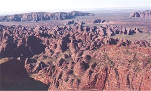
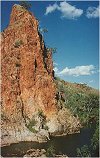
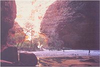
via Kununurra. Photo right
Shot from the Chopper hired at the Bungles |
 |
|
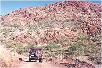
We actually took a detour along
the Buchanan Highway (sorry that's the Buntine Highway) and traveled over the "back track" into
"Mistake Creek Station" to visit friends. Wonderful country full
of wild camels & feral donkeys (The things that wreck the
country) and unusual terrain.
Next day we went fishing in the Negri River (no luck) (Still on
Mistake Creek) and then continued on the Duncan Highway South again to the
Buntine/Duncan Highway intersection The
highways are usually empty and dusty out here, so never fail to
ensure you have ample supplies in case of breakdown.
|
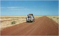
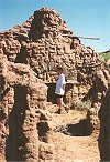
A lonely but good road
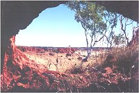
Window to the World at Mistake Creek
 |
 |
We
stopped for a snapshot of the WA / NT Border and then on to Saw
Tooth Gorge Camp (35 km out of Halls Creek on the road to
Kalkarindji). We usually camp here on our way through to the West. It is always good to go for a dip at the end of a
long days drive and unwind with a nice cold beer. (Besides there are not
too many spots without sharp spinafex grass around) |
 |
Passing Old Halls Creek and up to the Bungle
Bungles turn off on the bitumen highway that links Broome to
Kununurra. (Great Northern
Highway) The
Bungles road is a winding rough road that is improving each year with tourism
demand. It took us three hours to casually cruise in the 80 kms (less our billy
tea break at a spring) |
|
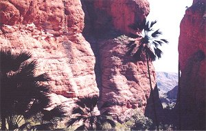
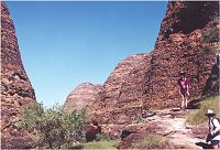
The Bungles has many walking trails that wind in and out of the
honeycomb rock formations. Each trail has its own uniqueness,
from Mini Palms Gorge to the Cathederal cavern walk.
Mini Palms was an eye opener.
The camp grounds were basic but great...maybe because it was pre
tourist season.
|
 |
 |
We forked out the credit card and
did a helicopter flight over the Bungles and it really put this natural wonder into
perspective. (Photo at top of page)
We even saw the Hale Bop Comet over several nights.
|
 |
It was a trip that we thoroughly enjoyed. The little known Bungles were a sight
to behold. Over the years they have become a major tourist destination, mainly
from the air with scenic flights from the regions towns as the road still
requires 4 wheel drive vehicle access.
We returned to Katherine via Kununurra and the bitumen
highways of "Great Northern & Victoria highways"
If you ever get the
opportunity, at least do a flight over Western Australia's Bungles while
traveling to/from Katherine NT
|
